Before our Ecuador trip is a distant memory, I AM going to get the posts that were ready to go posted.
On our first full day around
Cotopaxi we were signed up to do the big hike to the summit of Pasochoa
Mountain behind the hostel. The hike would be a steep one, gaining 2362 feet in
3.5 miles. I was nervous. In the night, I had convinced myself that I should
not do the hike because A. I didn't want to be the slow old person trying to
keep up with the 20-somethings, and B. I didn't want to re-injure my knee just
nine weeks after surgery. This would be the first big test and I wasn't sure if
I could or should do it. But at breakfast, Drew convinced me that I
should try and we could always turn back if the knee was not up to it. So up we
went. The first part of the hike was on a steep path through scrubby forest,
and I was too intent on keeping up to take many pictures. But it wasn't
long before I was confident I could hold my own with the group on the way up.
The knee felt good, and living at moderate altitude even gave us some
advantage over the younger lungs in our group.
 |
| Looking
back the way we had come about half way through the hike. |
 |
| Looking
up the way we were headed. Our route would take us up the ridge on the right to
the summit and around to the left and back down following the track on the
left. |
 |
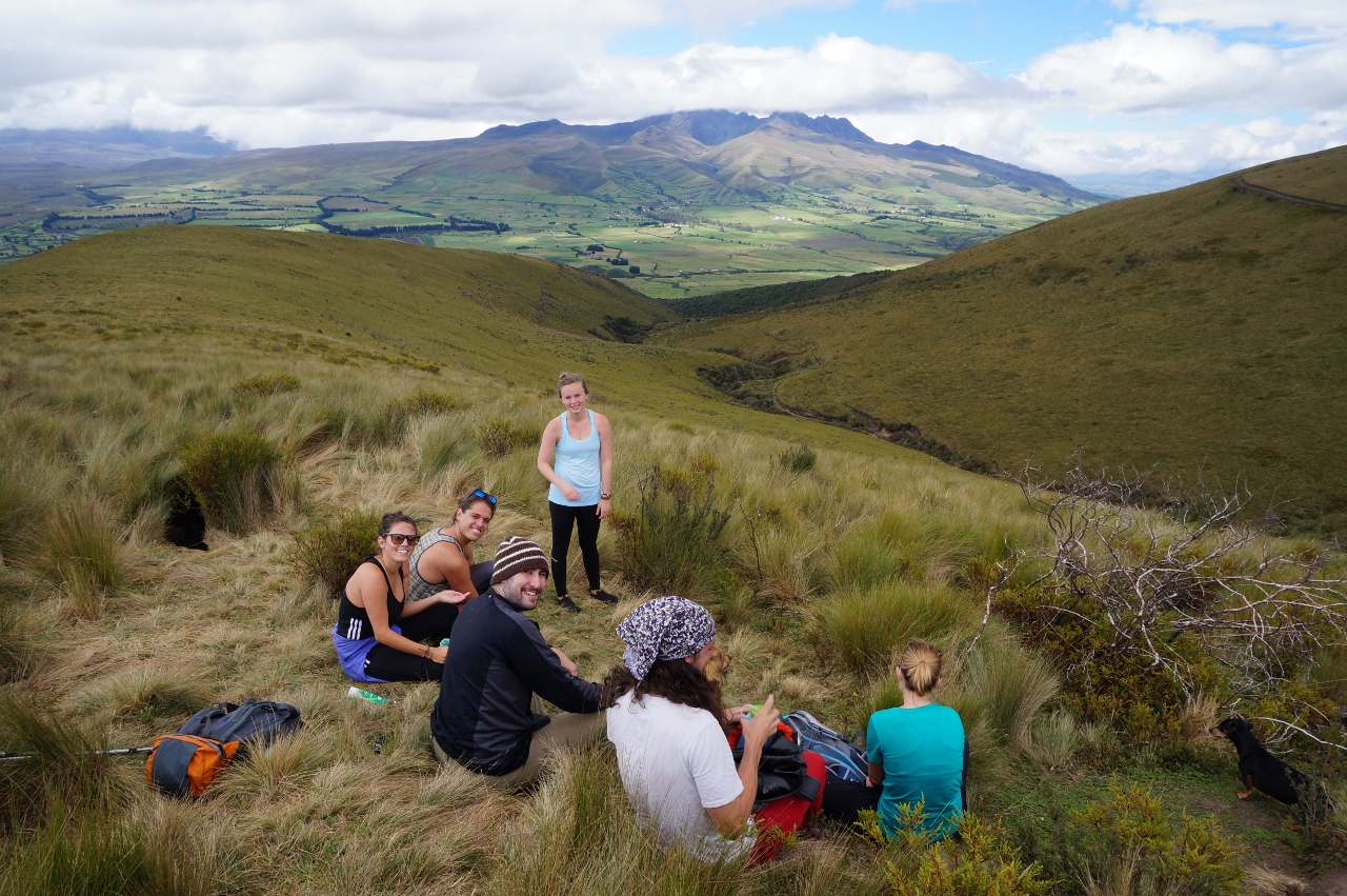
| Our band of hikers. |
 |
| Accompanying
us on our hike were the pack of resident dogs from the hostel, including two
Dachshunds. |
 |
| With
the summit nearly in sight, we continued up. |
 |
|
Gaining some serious altitude.
|
 |
|
Almost there!
|
 |
|
And we made it! About 3 hours of
hiking got us to the crater of Pasochoa, 13,842 feet above sea level. No
worries, this volcano is inactive.
|
 |
| The
clouds swirled in the crater, making it unnerving to stand too close to the
edge. |
 |
|
Our entire group after a lunch of
sandwiches, cake, and hot tea delivered to the top by our guide. Thanks, Victor.
|
 |
|
All five dogs made it to the top, as
they do every day with a new group of hikers. My 33-inch inseam is apparently
no advantage over the short little legs of the Dachshunds.
|
 |
| Since
we had driven in the dark for two hours in a taxi to get to Secret Garden, I
had no idea we would be close enough to Quito to see parts of it and even pick
up some cell service. |
 |
| What
else would you expect at the top of a volcano but a mess of fused volcanic ash
and clasts. | |
 |
|
Magma often squirts itself into
solid rock along fractures and usually weathers differently than the
surrounding rock, as shown by this dike.
|
 |
|
Time to head down. The trail is
actually so steep that the other hikers are hidden in front of us.
|
 |
|
A brief stop in a spring area
colonized by a strange type of wetland ground cover.
|
 |
|
The plant is tough and feels like
plastic.
|
 |
|
What would cause this unusual
alignment of scarps on the otherwise uniform slope? My guess is a dike in the
subsurface allowing preferential movement of groundwater and/or erosion.
|
I was definitely the slowest hiker
on the downhill, but not so terribly slow that the group had to wait a long
time for me. What a relief. On the way down, I made sure to snap a few
pictures.
 |
|
This irrigation canal may have been
built by the Incas, according to our guide.
|
 |
| Here
is the lower forested part of the trail. Definitely not IMBA standard. |
After 5.5 hours of pretty difficult
hiking for two people who don't hike so often, we were happy to complete the
journey and I was literally shouting for joy that my knee held up.
 |
|
Time for some post-hike hammock time
to let the blood run out of our tired legs and share a recovery drink.
|
We stayed in that position for quite
some time, then moved to the hot tub, and recovered just enough to eat a tasty
dinner of quinoa stuffed roasted pepper and socialize a bit before retiring to
our casita. We both agreed that this day was the highlight of the trip so far.


No comments:
Post a Comment