This post is about another routine day in the life of a hydrogeologist (me). For the past three years I have been doing a lot of field work in Snake Valley on the Nevada-Utah state line to set up a network of ground-water monitoring wells and spring discharge gauges. The purpose is to quantify the amount of water in the valley and document any changes to the hydrologic system. These pictures are from five days of work during an unseasonably cold snap (high of 45 and
windy) in October and a couple of pictures from this past week. This is the fun part of my job!
This (above) is Miller Spring. There is a spring in the middle of this pond, which used to flow through the dam that had been located in the foreground. The dam had eroded so I needed to repair it and insert a new culvert so that I could attach my flume to the pipe to measure the flow of the water through the pipe/flume.
Here is the new pipe going in. I had tons of help from the folks at Fish Springs National Wildlife Refuge and the Utah Department of Wildlife Resources (DWR). Fish Springs people are worried the proposed pumping by Southern Nevada Water Authority in eastern Nevada and Snake Valley will impact the flow of water to Fish Springs. The DWR people are worried the spring's flow will decrease, which will reduce the habitat for threatened species. The pond here is great habitat for Columbia Spotted Frog.
The photo above shows the new dam. The flow here is only about 1/3 cubic feet per second (cfs) or around 130 gpm. It was challenging to get the pipe positioned at the correct level so that habitat was preserved. The very cold weather and rising pond didn't help either. It took 60 cubic yards of fill material to reconstruct the dam - about twice what I had estimated because the last time I saw this site in March, the dam was still mostly intact.
Next up was Foote Reservoir. I needed to install a ramp flume here to measure the flow from some significant springs upwelling in the reservoir (not pictured). The marshland here is great habitat for Columbia Spotted Frog and Utah Least Chub, a small native fish, swim in the water.

Aaron from Division of Water Rights and two biologists from DWR helped me install a 7 cfs ramp flume in a location adjacent to the existing channel. First step was to excavate a pad location. Then we laid down railroad ties as a base. The flume is the silver thing to the left in the picture to the left.
It took almost all day, but we successfully installed the flume. Here is 30-second video of the water first flowing through the flume. The flow here is about 3 cfs.
Man, is this blog getting great or what? Hydrogeology is action packed.
Above is the mostly finished site. Our logging equipment will go in the upright steel culvert to the right of the flume.
Next stop was Twin Springs. There are two spring pools, each having a small stream flowing from them at about 1 cfs. I wanted to install 3.5 cfs flumes in both channels.
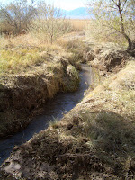
Above are before and after pictures of one of the channels at Twin Springs. This site was particularly hard because the channel was too narrow to divert the flow around the installation site so we had to do everything underwater.

The other channel at Twin Springs had a wider channel, so we diverted the flow around the flume installation site with a coffer dam while we installed the flume. Kevin from DWR is pictured above bailing out the muck from the installation site.
We installed the flume and backfilled (above left) with a mixture of gravel and finer material. There is a fair amount of hand shovel work (above right) involved.

Last week Aaron and I went back to install a water-level monitoring device inside the upright culvert to the right of the flume (pic right), the radio equipment and battery in the metal box on the pole, and a solar panel and antenna on the top of the pole.
By knowing the level of water in the flume, we can calculate the flow using a standard formula for this shape of flume. The level data are radioed to a repeater station about 15 miles away, which in turn relays the data to Garrison, Utah, where we have it tied into the State computer network. The
data are live on
our website (screen shot below) and the
Division of Water Rights website.
Yes, having live data means that
you can check it whenever you have insomnia. You can make all kinds of exciting graphs like this one (right).
So this fall I have had two hugely successful field work sessions. One more big trip and I think we will have the Snake Valley surface flow remote monitoring network complete!


